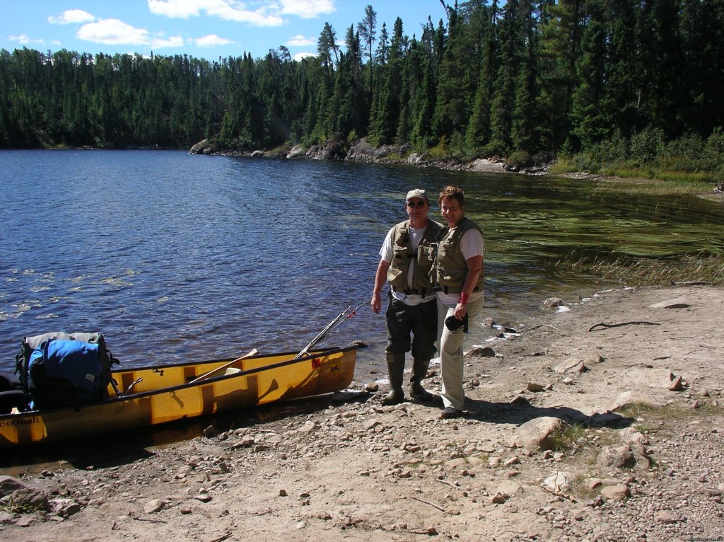
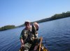
Canoe trip taken in 2007 into Quetico Provincial Park, a canoe only wildernessContributed By John & Lynn O'Kane - VNO
John & Lynn’s Fall Quetico Trip - Detours and Low Water
Lynn & I usually go out on our trip around September 10th since that is about the time things slow down a little at the shop. It happened that we had two customers that needed to be dropped off on the north side of Quetico, at Nym Lake. We chose to take advantage of the van ride and paddle the north side as well, starting at Stanton Bay which is about 20 miles from Nym.
The route was planned to take us from Pickerel Lake and out through Sturgeon, to Lac La Croix where a tow boat would pick us up and take us over to Crane Lake. The only thing I worried about was the Deux River. In low water conditions it can be impassable, so I called a Canadian outfitter I knew to get some info. He said that there were 3 beaver dams to pullover but you could still get through.
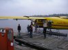
Day 1 - September 10th at 6 am we met the Shelton’s (father & son), packed up the van and took off. We had John Duke (aka “Dukeâ€) drive us up. We stopped in International Falls to gas up and get some breakfast. After crossing the border, we stopped in Canada to pick up some bait & our Ontario fishing licenses. (Note: as of 2007, no live bait at all will be allowed in Quetico).
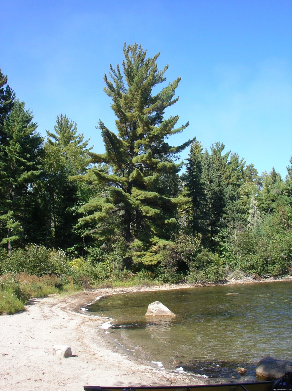
After we dropped of the Sheltons at Nym, we drove over to Stanton Bay. There is a quarter mile portage to Stanton Bay that has a large, nice boardwalk on it. Duke gave us a hand with the gear. Then we set off, heading south out of Stanton Bay. We entered Pickeral Lake, which is a large lake with lots of sandy beaches. At one time there was a large dam on Pickeral but between the years of 1978 - 1983, the dam was dismantled. This reduced the water levels 4 – 5 feet, down to their original levels and created the sandy shoreline.
We headed toward Emerald Island and Pine Portage Bay. As we got closer we spotted dark smoke curling upwards just ahead of us. A bit closer & we saw an area of Pine Portage Bay peninsula in flames, the fire snaking up the trees, burning the needles and making the sounds of a rather large bowl of Rice Krispies (snap, crackle, pop). We stopped and took several pictures of the blaze. As we left we saw a plane circling overhead.
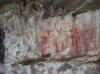
We headed over to the 94 rod Deux Rivieres Portage into Dore’ Lake. On the south end of Dore’ there are some Indian pictographs and right before the next portage we spotted a sunken barge just below the water. This barge was used by people moving west over the Dawson Portage in the 1870’s. The next 142 rod portage follows a shallow stream which leads to Twin Lake. After doing the portage into Twin we ran into 4 solo canoers who were coming from the Deux River area, which was where we were headed. They told us that they had just spent 2 hours trying to “do the Deux†and had given up! They had chest waders on and had mud almost all the way up. They had talked to a Quetico Ranger a week before who had given them the same info we had received, that the river was passable. Obviously conditions in the fall can change pretty fast. The same thing has happened to us when giving information on routes, luckily though, not too often.
I decided to change my route to exit at Beaverhouse Lake. This would still give us two days for ourselves and not increase the portaging too much. We found a nice campsite on an island on the south part of Twin Lake. It was set high up and had a great view. That night we listened to the small German shortwave radio I had brought and got up to date on football game scores. As we sat around camp we were also serenaded by the mournful howl of a nearby wolf pack not once but twice. When we woke up the next morning we were treated to another two serenades as well! This area is filled with wildlife. A Park naturalist has said that this one of the best parts of the Quetico to find moose, wolves, bald eagles and osprey.
Day 2 - That morning I used our satellite phone to call our office to inform them of the change & to have them switch the pick up point and schedule a flight out of Beaverhouse instead of a tow at La Croix. We backtracked our way out to Pickeral Narrows and met Matt Shelton & his dad paddling towards us. We gave them the bad news about the Deux River and suggested they go around through Bisk, Beg, Bud, Fern and Olifaunt to get to Sturgeon, which was their next goal.
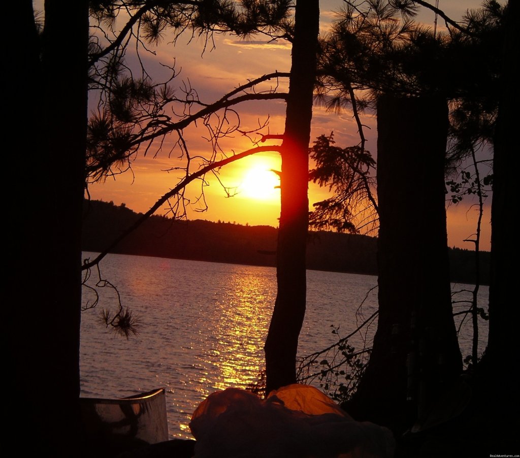
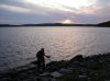
At the end of Pickeral there is a narrow spot which shows 2 portages on the map. We were able to paddle through the first area but had to do the next short portage. At that portage we met a Canadian couple who were traveling with their two gorgeous and well behaved malamute/husky dogs. We were now on Batchewaung Lake where we settled in at an island campsite with a great view of the evening’s sunset.
We had two short portages, in and out of a small pond to get into McAlpine Lake. The map shows just one portage but there is a large beaver dam which must be portaged around. McAlpine is a long lake, five miles long, and narrow. There is a small rock cliff which has an Indian pictograph as well as some kind of spiral abstraction. The west side of the lake is very shallow and littered with large tree stumps. The portage out of McAlpine is a series of portages around beaver dams. We spotted a muskrat on the shoreline and a large flock of Canadian geese.
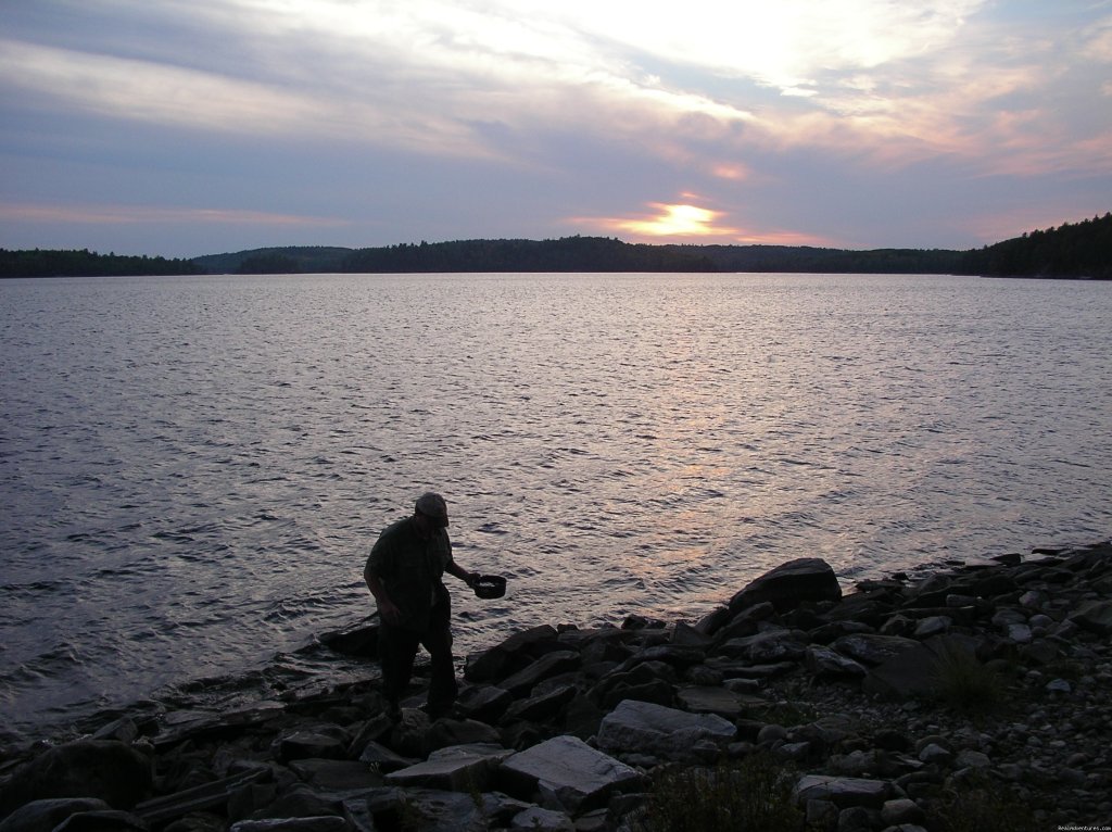
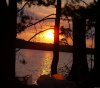
Day 3 – 4 Once on Kasakokwog, we followed the north shore down to the middle of the lake where there is a bunch of camp sites. My buddy, Jeff Hway, told me about a nice sandy beach site. We found it and set up camp, planning to stay here for two nights. It was very nice, sand beach, facing west, set in a big stand of red pines, with a small island in front of it. After dinner we enjoyed a great sunset. When it got dark I lit up the lantern (Quetico had a fire ban). We had a cocktail and talked about how the trip had gone so far. Except for the low water, we had great weather and the wind at our backs.
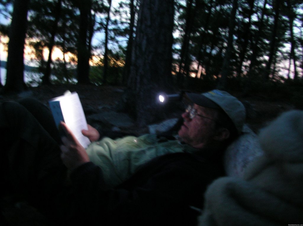
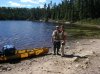
The next morning we slept in late & then got up to do some fishing. Since I knew nothing about this lake, I decided to do a lot of trolling. We took our rod holders & heavy rods set with 17# test and a #8 deep diving Shad Rap. After a few passes we picked up some pike and a few smallmouth bass off a point near our campsite. We switched over to crawlers & jigs and caught some more bass. After fishing we went for a swim, did some reading and then got our stuff ready for traveling the next day. We had a great dinner which included some of Cache Lake’s fry bread, yum!
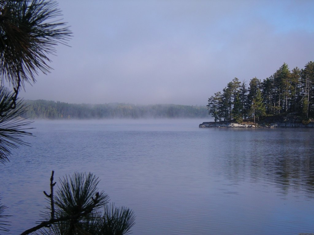
Day 5 - That morning we woke to a beautiful blue sky. We jumped into the canoe and took off. We had another three miles to cross Kasakokwog and we checked out a couple campsites along the way. Back in the southwest corner of the lake is a 75 rod portage which was very rocky. We were able to paddle down the creek a ways before we had to portage. There were about three beaver dams we had to either go over or walk around. The last quarter mile was low water & very mucky and we sank to our knees in mud. We were very happy to finally spot Quetico Lake.
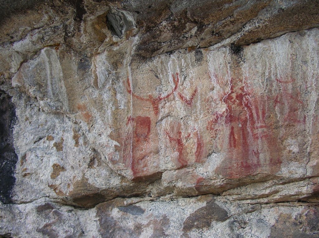
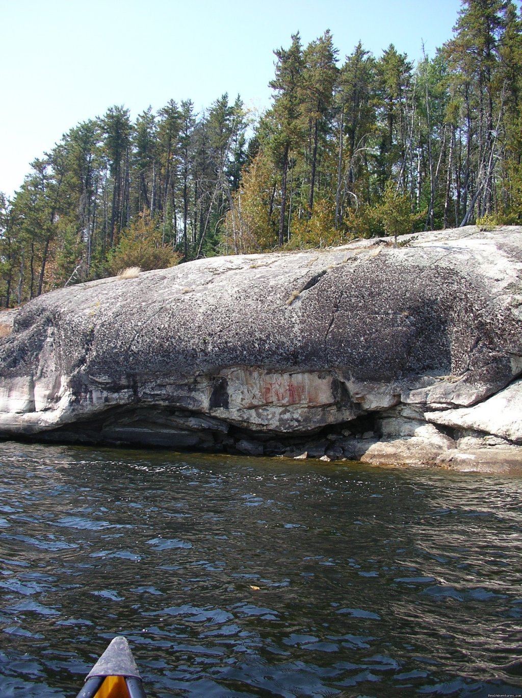
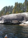
The wind started to pick up from the southwest, right in our faces. This wind forced some smoke and ash toward us from a fire in Quetico Lake. We made our way through some islands and were able to use them for a shield. Finally the wind calmed a bit and we were able to explore the rugged, rocky northern shoreline. In Quetico Lake there are at least four displays of Indian pictographs, all relatively easy to spot since they are at the base of steep cliffs. The easternmost set is exceptionally good and is nearly hidden under a low rock overhang. This one has many figures; a moose, a canoe, three people, a caribou and several abstract drawings.
Day 6 - We paddled past the narrows that lead to Cirrus Lake and began to look for a campsite on Eden Island. We found one right away that Lynn went to check out. It was very high, set on a granite ledge just off a long winding trail and would have taken a lot of work to get our gear there, so we passed it up. We found one near Eden Island, very nice but with one drawback, it was exposed to the wind. The next day it was very windy and the lake had a good chop to it. We fished off shore and got a few bass and pike. Afterwards we went back to finish reading our books and then got everything ready for an early departure the next day.
For breakfast our last morning we had Harvest bars & Kool-Aid. The wind wasn’t too bad but we could see rain moving in. We paddled to a big point off Eden Island and took a small break. From this point we headed west into a narrows. There were a lot of beautiful red maples found here. We also saw a bunch of mergansers and an osprey. This was a perfect area to take pictures.
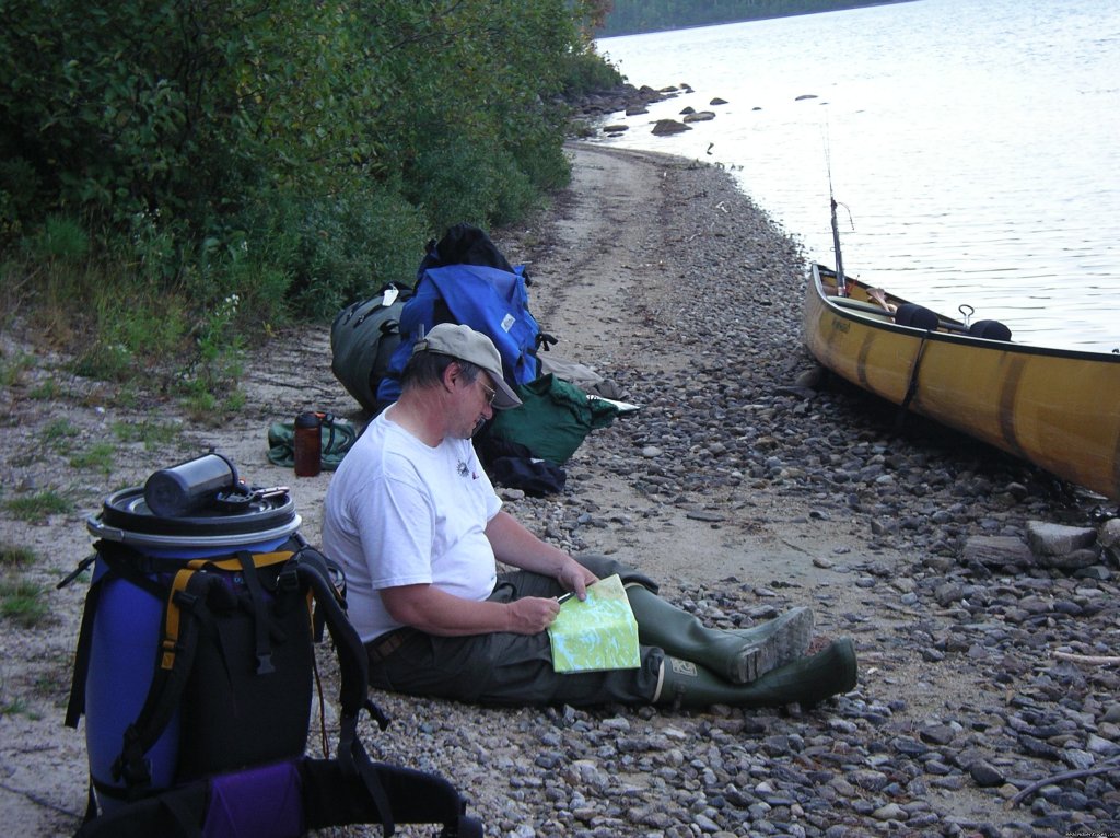
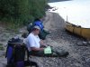
Just as we started the next 24 rod portage it began to rain on us. After the portage we followed the south shore down a little. A mile after a big point there is a nice sandy bay and that is where the Canadian Ranger Station on Beaverhouse is located. This station is closed after September 6th. We reached the shore around 9:30 a.m. and it began to rain harder. We spotted two other people who had just pulled up to the station. We all took cover in an old cabin that had sort of an enclosed porch on it. The couple, Patty & Paul Payne, was also waiting for a floatplane to pick them up. Their flight was supposed to be at 9:30 and ours was to be at 1:30 p.m. With the low cloud ceiling, neither appointment looked like it was going to happen.
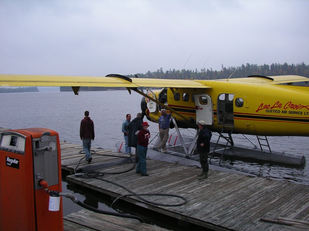
Paul & I took a canoe out on the lake to try for a better satellite connection. They called Jay Hamburg, owner of Campbell’s Cabins of La Croix & Quetico Air Services. Jay said he couldn’t promise anything but there was a slight possibility of a small air opening for around 2:00 p.m. While waiting to hear a floatplane arrive, we sat on the porch and chatted with the Paynes. Then Lynn took out our Coleman Max Expedition stove and made a nice hot soup, combining our wild rice soup mix with Patty’s cream of broccoli. After lunch the rain has subsided quite a bit so we decided to explore a bit. We checked out the other cabin, seeing if we could sleep there overnight since we didn’t really think we’d get picked up that day. But then at 1:45 we were startled by the sound of a large plane overhead. We couldn’t see it until it hit the water. Jay had sent an Otter plane (one of the largest floatplanes) and his most experienced pilot, Rob, who was 65 years old. Patty knew Rob from previous flights and said, “I like my pilots with gray hair!â€
We loaded the plane but were only able to put one canoe on it. Our canoe was left behind and Jay would have it picked up the next day. We flew so low that we were able to clearly see the colorful trees we soared over. Rob had to make a quick turn to avoid a fog bank and was only able to take us as far as Crane Lake, not all the way to Ely. I had called our shop and had a driver bring a van up to Crane Lake. After landing at Crane and checking in at the U.S. Customs, we went over to Scott’s and bought a couple beverages & some snacks. Soon our van pulled up and we took the drive back to Ely. The drive on the Echo Trail was a maze of reds, oranges and vibrant yellows and was a gorgeous way to end our trip.
We had a great trip with six out of seven days having great weather. We saw & heard lots of wildlife, viewed lots of pictographs and experienced wilderness fires, luckily without being threatened by them. A great trip indeed!
John & Lynn O'Kane - owners of Voyageur North Canoe Outfitters since 1981. We take at least 2-3 canoes trips ourselves, each year.
Nearby Attractions and Serviceskeyboard_double_arrow_up
Get your free travel newsletter full of inspiring travel ideas, great deals, destinations and adventures. Discover new places to explore, new adventures and new experiences.
See latest edition.