PAKISTAN'S NORTHERN AREAS
GILGIT, HUNZA & THE KHUNJERAB PASS
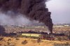
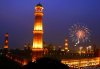
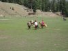
GILGIT - the main trade centre for hundreds of square kilometers. It is a busy centre for Pakistan's north and trade with China. For all that it still has a slow, relaxed pace. We would not recommend though that you spend too much time in your itinerary in Gilgit but more as a transit point. An excursion of approximately 90 minutes to see the Kargah Buddha rock carving can be planned in programmes. Gilgit is the home of polo and a wild version of the modern game can usually be observed most afternoons from Spring to Autumn as a practice match. The highlights of the annual polo season are the Azad-e-Gilgit (Gilgit Independence Day) match 1 November and each July against Chitral at the Shandur Pass.
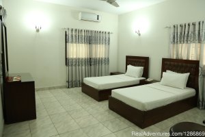
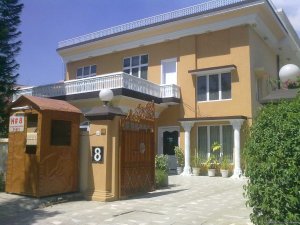
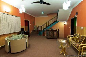
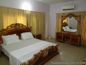
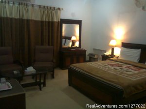
Gilgit has a range of hotels from 4 star to good tourist class (some have air-conditioning, others aircoolers or fans only, heating is provided in winters in selected hotels only).
Gilgit's airport services the area including Hunza and the Khunjerab Pass, the gateway to China. For planning purposes, flights are unreliable, as they are only reconfirmed 20 hours prior to departure, subject to the previous days departures, backlog of bookings and operate subject to weather. The 45 minute Fokker services operate in the morning. A backup system is prepared in case flights do not operate or PIA will not give reconfirmation (due to backlog of bookings) but it is strongly recommended travellers plan for this contingency by:
a) allowing a full additional free day following the flight in case you have to travel to Islamabad road;
b) funds be set aside for additional nights accommodation enroute (subject to availability) and road transportation.
The airfare would receive a 100% refund and hotels onwards are advised reservation is subject to flight (although it is at the discretion of the hotel as to whether any cancellation charges would be incurred).
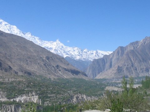
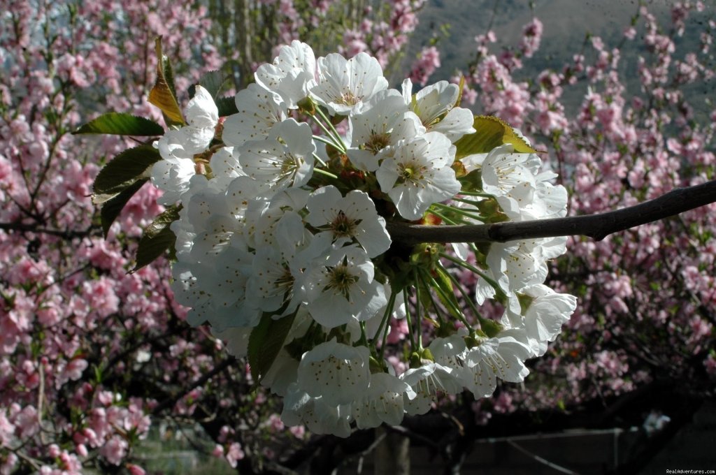
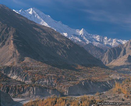
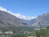
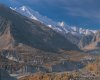
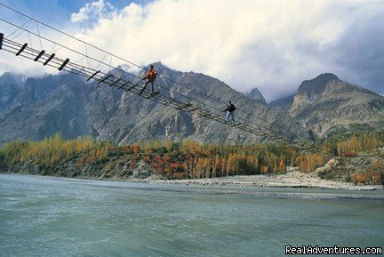
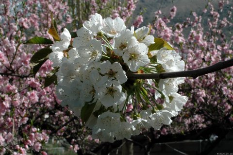
HUNZA - at its best from spring (mid-April/mid-May) with fruit and nut trees in blossom and autumn (October) when the trees turn brilliant orange, red and brown. A contrast against the panorama of snowy peaks. As you near Hunza view spectacular Rakaposhi Peak with its snowy crown. For anyone wanting to walk, there is a good walk of 2 hours towards the Peak's glacier. The highlight of Pakistan's Northern Areas is Hunza, comprising of a string of villages along the Hunza River and Karakoram Highway (KKH).
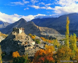
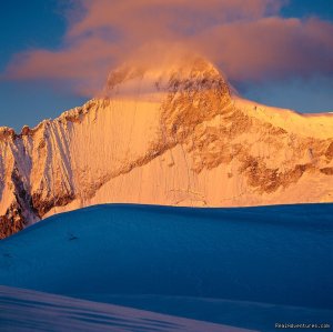
KARIMABAD, the main centre for Hunza is like a stage setting. The attractive crescent-shaped valley laid out before you is encircled with mountains. Views in one direction include Ultar Peak (7388m) and in the opposite direction Rakaposhi (7788m), undoubtedly the most prominent and well-known mountain in the Gilgit/Hunza area.
Imposing Baltit Fort is the former palace of the Mirs (rulers) of Hunza until 1960. It is now a museum dedicated to the conservation of the Hunza people's history and culture and is a must for all visitors. It soars above the village of Karimabad, with Ultar Peak and its glacier as a curtain backdrop and commanding a majestic view of Mt. Rakaposhi and Diran Peak (7266m). The views of the surrounding snow-capped mountains from Karimabad is spectacular.
Karimabad is Hunza's main centre for tourism and has an extensive range of hotels. We favour several hotels within the tourist class category and price-range. A traditional Hunza meal can be included in your programme to sample such dishes featuring apricots and the oil from the fruit's kernel, walnuts,local cheeses and yoghurt.
ALTIT: is a small neighbouring valley to Karimabad, with a very old, small fort perched on a rocky outcrop high above the Hunza River - the only river that cuts through the width of the mighty Karakorams. The fort's balcony overlooks a village of mud houses with flat rooftops used as extra work areas. The fort itself may be closed to visitors from time to time in 2000 as restoration work is underway.
DUIKER VIEWPOINT - an early morning jeep excursion can be taken to Duiker Viewpoint from where you will see sunrise overlooking magnificent snow-covered peaks including Ultar (7388m), Rakaposhi (7788m) and Diran (7266m). Following breakfast at Duiker, return down to the villages to visit Altit. Sunset programme can also be arranged but for a unique experience, we recommend a stay overnight at Eagles Nest, a small hotel of 6 rooms (each with own bathroom) with panorama views. For those who want to walk to Duiker, the trail from Altit village follows a jeep track and short-cuts locals have made to fetch water (can be quite steep in parts). You will pass through a friendly rural environment.
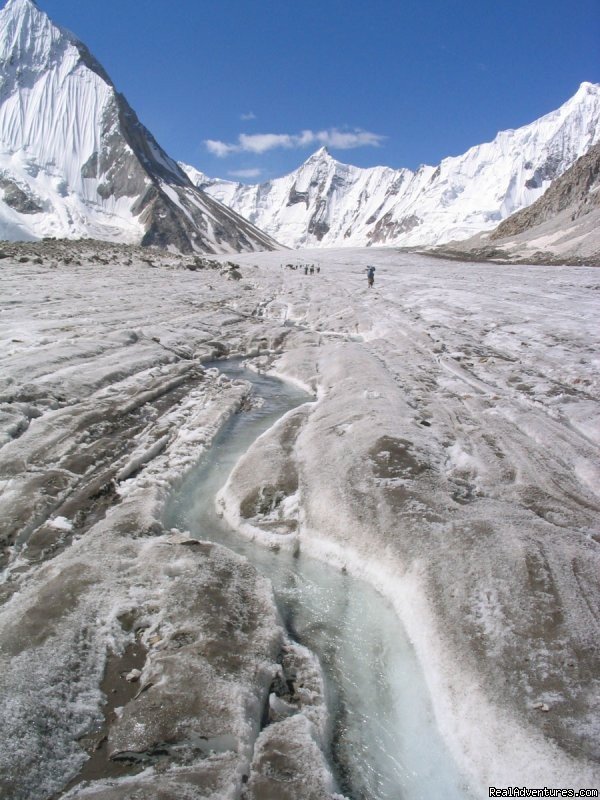
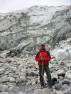
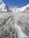
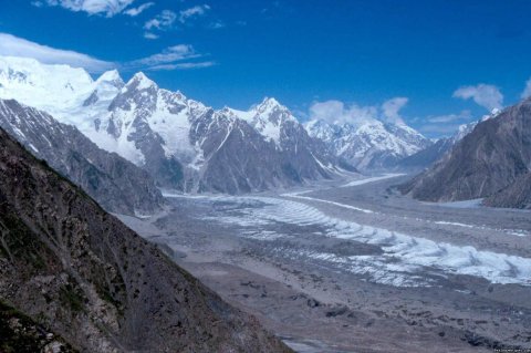
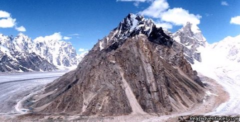
NAGAR VALLEY - which can be seen from Duiker is on the opposite, eastern side of the Hunza River. This is another fertile valley and is predominantly Shia Muslim. A half day excursion to probably one of the world's fastest moving glaciers at Hopar. This glacier leads down from Karakoram Mountain range.
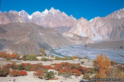
GULMIT VILLAGE: in Upper Hunza, approximately 40 km further north of Karimabad and nestles beneath Ghulkin Glacier. This village gives the visitor the opportunity to experience a smaller Hunza community. The Mir of Hunza would once stay in a royal guesthouse, which is situated by the village polo field. The community organises several festivals each year to celebrate their traditional dance and polo. Several small and friendly tourist class hotels are available in Gulmit. A hike of 4 hours (one way) takes you to Boreet Lake, crossing Ghulkin Glacier (no technical skill or equipment required). From Boreet you can return to the KKH and onwards to your next destination. Excursion to Boreet can also be made by local jeeps. Camping is possible by Boreet.
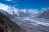
PASSU: is Upper Hunza's other main village and is some 70km north of Karimabad. It is fed by Passu and Batura Glaciers around the base of which the KKH winds. Passu is wrapped in an array of peaks, the most impressive landmark being the "Passu Cathedrals" a series of cone-like pinnacles. Passu is Hunza's main trekking centre and also serves Shimshal Village and Plateau on Hunza River's eastern banks. Simple tourist class hotels cater to the many trekkers and visitors to this friendly village. Passu villagers take their herds to the Batura Glacier each year to a series of pastures for the summer months. Hundreds of sheep, goats and yak can be found at these pretty pastures until end of August.
MISGAR & CHIPURSAN VALLEYS – both these valleys are located north-west of Sost and lead to the Pamir Mountains. Both valleys were only opened to foreigners in 1999. The villagers are very receptive to their new visitors and we take good care that tourism does not have a damaging impact on these fragile communities.
MISGAR - the narrow valley has a small, but beautiful river cutting through the valley floor. Kalandarchi Fort, still occupied by the Pakistani army, is perched at the end of the jeep road. A short walk takes you to the first campsite which overlooks the river. In spring Marco Polo sheep & ibex are seen down at the riverside. The river also has a large quantity of fish. Misgar Valley leads to the Kiliq & Mintka Passes – the original Silk Routes to China & Afghanistan respectively. Mintka Pass goes into the Wakhan Corridor in Afghanistan. This is also a pleasant valley for a day excursion from Sost or Passu.
CHIPURSAN – a long, narrow valley leading to the Wakhan Corridor. The approach into the valley is along a narrow jeepable road cut high above the river. This is a good valley for cycling (look for our cycling programmes). The villagers have a deep history with horses and are keen polo players.
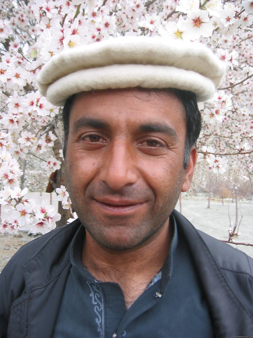
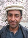
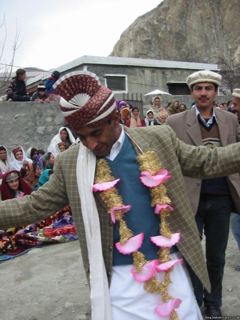
HUNZAKUTS are famed for their long-levity - some to over 100! This unfounded reputation is the result of their healthy and unique diet consisting heavily of walnuts and fruit, particularly the apricot, which grows abundantly. Life is fairly simple here and time has a slower pace - there are less stresses than those which are known in the cities. Their existence though is very tough and everyone works extremely hard. Hunzakuts are Ismailis - a moderate sect of Islam whose religious leader is the Aga Khan. With their distinct culture and their own languages the people are extremely proud of their Hunza heritage and are happy to welcome visitors. Until 1974 Hunza was an independent kingdom, greatly isolated until completion of the Karakoram Highway (KKH) to China in 1978. They have a rich history though of attacking and being attacked by invaders and with prosperous trading along the silk route, gaining many spoils from raiding the caravans. The visitor today will receive a very different welcome though, as Hunza is renowned for its friendly welcome.
NALTER VALLEY
The route To Nalter used to be part of the Old Hunza road prior to the construction of the Karakorum Highway. It is dry and dusty until you reach the extensive cultivated area of Nomal. This entrance to the Nalter Valley is an unprepossessing means of access to a lovely valley behind, an area of glacial lakes, pine forests and alpine meadows penned in by snow covered peaks. Ideal for skiing, the Pakistan airforce has a setup for winter survival training at Nalter. The lower reaches of Nalter are confined within a hot, rocky, narrow canyon but at upper Nalter the valley opens out to reveal lush green alpine meadows and pine forests.
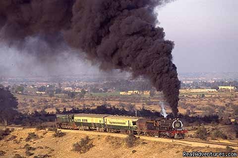
THE KARAKORAM HIGHWAY (KKH), completed in 1978 was a joint Pakistan and China project, taking more than 20 years to complete. The KKH leads to China via the Khunjerab Pass, opened in 1982. Rock inscriptions along the KKH have given inconclusive evidence that the Indus was the gateway to the spread of Buddhism from the Kingdom of Ghandara (Taxila more particularly) to China. The Shatial rock inscriptions, petroglyphs are carved on hundreds of rocks along the bank of the Indus River for the 70km extending past Chilas, dating back to the first century BC.
The carvings on the Ganesh rocks near Karimabad have early inscriptions and drawings, including hunting scenes of ibex from early traders on the Silk Route.
Between Chilas and Gilgit the road winds round the foot of Nanga Parbat (8125m), world's ninth highest mountain and last in the Himalayan Range. If travelling to Gilgit by road you can view the meeting of three of the world's greatest mountain ranges: the Himalayas, Karakorams and Hindu Kush.
The north is a high-altitude desert, hardly receiving any rain, the main water supply coming from melting snow. The KKH bends and twists on the ledge of cliff faces crossing several Chinese-built bridges from one side of the river to the other. Extreme variations in temperature and weather conditions add to the atmosphere. Small villages are like oasis with their irrigated fields and orchards, in stark contrast to the naked mountains all around.
The route enters the Khunjerab National Park where the hills and valley open out. Final ascent to the top is covered by twisting round 12 hairpin bends. Although almost impossible to glimpse, this area is home to the snow-leopard, Marco Polo sheep, wild goats, yak, ibex, and several rare birds and animals. At 4733m, it is the world's highest paved boarder crossing. Even the slightest exertion leaves one breathless.
OTHER STOPS ON THE KARAKORAM HIGHWAY (KKH):
SOST – last village on the KKH and the approach to China. Sost is by first impressions a busy little trading centre with many jeeps awaiting travellers & traders from China. Just a short distance away from all the commotion though are two peaceful villages of the Wakhi and Burushaski. Sost to the eastern side of the KKH is approached either by foot or jeep and remarkable views can be taken from the rocky plateau above the village or a visit to the irrigation tunnel. In the other direction, crossing a small suspension bridge is Khudabad (God's Land) from where you can have a pleasant couple of hours walking.
TO CHINA: Sost is the location for Pakistan's Customs & Immigration offices for those travelling to/from China. It is not necessary to have a Chinese visa to go to the Khunjerab Pass as you are still in Pakistan, but if you are planning to proceed to China a visa must be obtained in advance and cannot be granted at the border. This applies in the same case if travelling to Pakistan from China. A visa must be obtained from a Pakistan mission in advance and is not obtainable at the border. A re-entry visa is required in such cases if you plan to return to Pakistan. It is approximately 2 hours drive from Sost to the Khunjerab Pass and another 2 hours 40 minutes to Tashkurgan, the Customs/Immigration post for China. Overnight accommodation available (tourist class) at both Sost and Tashkurgan (the later is very busy in summer months and accommodation should be reserved well in advance). It is another 40 minutes from Tashkurgan to Lake Karakul where you can stay overnight in traditional Yurts and 4 hours more to Kashgar. Xinjiang Province, China follows Beijing time, which is approximately 3 hours difference with Pakistan.
BESHAM - situated on the bank of the mighty Indus River is a major stopping-point on the Karakoram Highway. It is the crossroad to Swat Valley over the scenic Shangla Pass (which closes over winter due to snow - we do not recommend programmes on that route between November and end of April). There is a good government hotel (PTDC chain) at Besham located in an attractive setting by the Indus River. Besham is 6 hours drive from Islamabad; 5 hours to Chilas, another rest-point and 8 hours to Gilgit.
CHILAS - another rest-point located by the Indus River on the Karakoram Highway. It is in stark contrast to Besham in that the area is extremely sandy, like a desert, with small pockets of irrigated farming areas. Chilas area has many hundreds of rock carvings some dating back 2000 years. There are several simple but comfortable and very clean tourist-class hotels at Chilas.
Near Chilas on the route to Gilgit the Karakoram Highway hugs the base of Nanga Parbat (8125m), world's ninth highest mountain and last in the Himalayan Range. On the approach to Gilgit there is also a point to view the meeting of three of the world's greatest mountain ranges: the Himalayas, Karakorams and Hindu Kush.
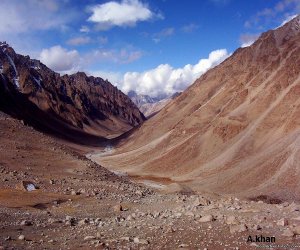
SKARDU - To approach Skardu the road crossed the Gilgit River some 40 km south of Gilgit. Following the Indus for some 170km where for most of the route the road hugs the north bank of the river to enter Skardu. The valley widens and large sandy banks flank the river when it is not in flood with melting snows. From spring to autumn the valley takes on a much more attractive appearance with fields and orchards coming alive with colour in stark contrast to the grey surroundings. In no other part of the world is there such a large number of high mountains in such a confined space as in Baltistan. Baltistan is part of the northern region's high-altitude desert, which receives very little rainfall. With its rolling sand dunes and barren mountains, Baltistan looks like Tibet and is often referred to as 'Little Tibet'.
Approach by flight from Islamabad (1 hours) is over a dense area of mountains and high altitude lakes not reached by man. It is probably one of the most beautiful domestic flights in the world. The flight is subject to weather though, and can be very unreliable in the monsoonal months of July through to end of August.
SKARDU TOWNSHIP: this is the capital and the major trading centre of the province of Baltistan.
The town of Skardu has a small bazaar area. Being the crossroads of Baltistan, it has a rich ethnic colour about it and together with your guide you shall be able to experience the culture of the people, for centuries almost entirely cut off from their neighbours. Please note that the majority of Baltis are Shia Muslims and are quite conservative. Very few women are seen in public places. Please dress accordingly whilst on excursions and visiting the bazaars and Mosque. The 16th century fort, Kharpochu, is a maze of stairs and passages. Good views can be taken of the Indus River from the rocky outcrop on which this fort was built. Shangrila Resort in its pretty lake-side setting, is about 40 minutes drive east from Skardu township.
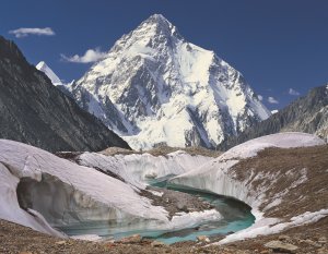
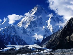
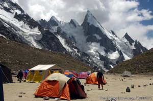
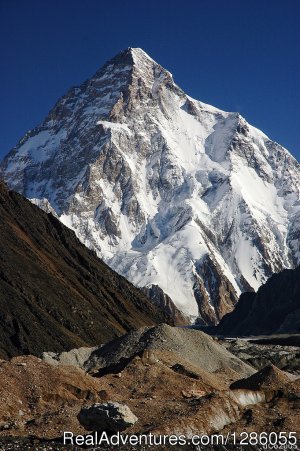
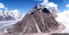
SHIGAR: Travel west from Skardu over desert-like landscape similar to Tibet to Shigar Valley. Large sandy banks flank the river when it is not in flood with melting snows. A broad, fertile valley ringed by peaks, several snow-capped year round, Shigar's orchards produce some of Baltistan's best fruits including apricot, mulberry, apples, peaches, plums and nuts. This former independent kingdom is headed by a town of the same name. It has some very impressive old wooden houses. Its main mosque has a three-tired roof built by the Kashmiris when they ruled the area more than one hundred years ago. A very pleasant area to wander. In fact, Shigar is the gateway for high altitude mountaineering & trekking particularly to K2 (second highest peak in the world), Broad Peak, GI & GII along with hundreds of other high mountains.
SATPARA LAKE: a beautiful lake with a small island which for most of the year is a deep blue. You can hire a boat out onto the lake. There is a small fish farm where you can purchase fish and have it prepared for a meal. See the Buddha rock carvings from early pilgrims which is on your way back to Skardu.
UPPER & LOWER KACHURA LAKES – a tourist class resort with its pretty lake-side setting, is about 40 minutes drive east from Skardu township. Located at Lower Kachura Lake you can walk a jeepable path to Upper Kachura village and its pretty lake set in an volcanic-like bowl.
SOKH VALLEY: The access to this valley is only some 5 km from the Shangrila Resort. Its lush green valley makes this a very scenic contrast to the area around Skardu township. Its streams are renowned for trout fish and you might like to take the opportunity to try your luck. This valley is a favourite picnic area, particularly in the summer months. Approximately 1½ hours into the valley is the village of Shagar Tang at 3,660m. This will be our major day excursion during the Spring months.
KHAPULU VALLEY: Khapulu is a beautiful valley from where the River Shyok (103km) descends into Skardu. A sprawling village of terraces on the hillside overlooks the river. An old royal palace for this once independent kingdom sits above the village. This is a very beautiful area to do day hikes. It is approximately 5 hours drive east of Skardu township. PTDC have a very nice small hotel to service this area. From Khapulu it is recommended for hikers and trekkers to take a jeep to the nearby Hushe Valley from where you can do day hiking or longer treks (although a lot of the areas beyond Hushe are restricted, therefore please discuss any proposed treks with us). An attractive alternative return route to Skardu on the opposite side of the Indus River. This is the old traditional route and passes through many small villages.
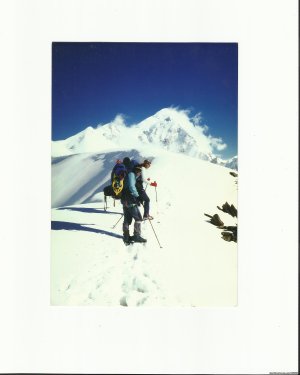
THE DEOSAI PLATEAU: At an altitude of some 4000 meters, the Deosai is a plainland wilderness, which is hardly known to the outside world. The pass opens mid-June through to end of September. From the Deosai Pass you get very nice panoramic views. During the summer months, the 400 km2 plateau this is a good area of jeep safari and camping. From mid-July to late August the plateau is covered in beautiful wild flowers and it earns its local name of “Bhear Sar' meaning Place of Flowers. There are many streams on the plateau and Shaucer Lake from where you can see Nanga Parbat (8,126 m). A project established in 1993 recording the declining number of Himalayan Brown Bears (Ursus arctos Isabellinus) and their
movements operates in the Deosai over the summer months. You can visit their research camp and join the researchers to hear more about the bears and their work. Sightings are not common, but you might be fortunate!
BASHO VALLEY: Located 40km or 2 hours drive away from the Shangrila Resort. With lush green forests, this is a very scenic valley accessible from June.
PAKISTAN AND THE GANDHARAN BUDDHIST HISTORY
Since time immemorial the civilizations of East Asia, Central Asia and the Mediterranean have been in contact with the other. Little by little interlocking paths were made by early travelers, merchants, soldiers, pilgrims and monks. Gradually, these routes joined together to extend over huge distances, over which certain prized goods, such as Chinese silk, were transported, passing from one group of people to the next. The symbolic name of "Silk Routes" was given to this network of East-West exchange towards the end of the 19th century.
The merchants who travelled the Silk Routes did not just carry goods with them, they also brought ideas. In particular, the Silk Roads were a major channel for the spread of religions throughout Asia and Europe. Older religions, such as Buddhism, spread from India into Central Asia and China, while several new religions emerged including Christianity and Islam. Each religion was to exercise a huge influence on its followers, not just in their everyday life, but in their arts, literature and politics. These religious influences are reflected in the archaeological finds made along the Silk Roads.
The spread of the Buddhist religion through Pakistan and Afghanistan was hastened by the conversion to Buddhism of the rulers of the Maurya Kingdom of northern India in the 3rd century BC. Artistic traditions were developed in Gandhara; a former province of the Persian Empire reached by Alexander the Great in 327 BC. Buddhism and Buddhist art with a strong Graeco-Roman influence continued to thrive in Gandhara for several hundred years after the fall, in the 4th century of the Kushan Empire, patrons (particularly in the person of "Kanishka") of the religion. The two traditional Buddhist arts, painting and sculpture, flourished in the monasteries of particular regions including that of present Pakistan.
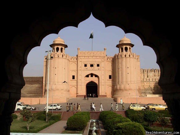
TAXILA - one of Asia's most exciting historic cities, encompasses monasteries, temples and whole cities built by the various peoples who settled in the area (Kushans, Scythians etc). It was at Taxila that Alexander the Great first encountered the holy men of India. The distinctive Gandhara School of art flourished there, a millennium before the Renaissance in Europe. Enroute between Besham and Islamabad we usually include a stop at Taxila, one of the renowned archaeological treasures of Pakistan. Visit the Buddhist stupas and monasteries of Dharmarajika, Julian and the ruins of Sirkap city (185BC to 80AD). Also included is a visit to the Taxila museum, which houses much of the relics and artifacts of the 1000 year old history (516BC to 600AD) of this archaeological heaven. Taxila can also be included in sightseeing from Islamabad or Rawalpindi as either and half or full day.
ツアー
桃æºéƒ·ãƒ•ãƒ³ã‚¶ã‚'訪ãã¦
æ–°ç·‘ã¨æã®èŠ±å'²ã春~æや林檎ãŒãŸã‚ã‚ãªå¤ï½žãƒãƒ—ラãŒä¸€å¸¯ã‚'黄色ã«æŸ“ã‚る紅葉ã®ç§‹ã€æœ€å¾Œã®ç†æƒ³éƒ·ã¨ã„ã‚れるフンザã‚'訪ãã¦ã¿ã¾ã›ã‚“ã‹ã€‚
フンザ人日本語ガイドã«ã‚ˆã‚‹ã€å¼Šç¤¾ãªã‚‰ã§ã¯ã®ã‚¹ãƒšã‚·ãƒ£ãƒ«ãƒ»ãƒ„アーã‚'ãŠå±Šã‘ã—ã¾ã™ã€‚(8日間~。ãŠã™ã™ã‚ã¯ï¼‘3日程度ã®ãƒ„アーã§ã™
トレッã‚ング
ナンガ パルãƒãƒƒãƒ‰ãƒ»ãƒ•ã‚§ã‚¢ãƒªãƒ¼ãƒ¡ãƒ‰ã‚¥ãƒˆãƒ¬ãƒƒã‚ングã¨æ¡ƒæºéƒ·ãƒ•ãƒ³ã‚¶
樹林ã«ç¸å–られãŸç¾Žã—ã„è‰åŽŸãƒ•ã‚§ã‚¢ãƒªãƒ¼ãƒ»ãƒ¡ãƒ‰ã‚¦ã‹ã‚‰ãƒŠãƒ³ã‚¬ãƒ‘ルãƒãƒƒãƒ‰ï¼ˆ8,121ï½ï¼‰ã®ãƒ™ãƒ¼ã‚¹ã‚ャンプ(3,967ï½ï¼‰ã¾ã§ã®ãƒˆãƒ¬ãƒƒã‚¯ã€‚
ãã—ã¦ã€æœ€å¾Œã®ç†æƒ³éƒ·ã¨ã„ã‚れるフンザã¸