Day 1: Machame Climbing Route Mount Kilimanjaro Track/Climb
Machame Gate to Machame Camp
Elevation (ft): 5,400ft to 9,400ft
Distance: 11 km
Hiking Time: 5-7 hours
Habitat: Rain Forest
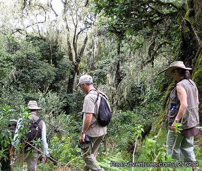
The drive from Moshi to the Mount Kilimanjaro National Park Gate takes about 50 minutes. The journey passes through the village of Machame which is located on the lower slopes of the mountain.
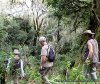
We now leave the park gate and walk through the rain forest on a winding trail up a ridge. Lower down, the trail can be muddy and slippery. Gaiters and trekking poles are a good idea here. We continue a short distance until we reach the Machame Camp.
Day 2: Machame Climbing Route Mount Kilimanjaro Road/Hike
Machame Camp to Shira Camp
Elevation (ft): 9,400ft to 12,500ft
Distance: 5 km
Hiking Time: 4-6 hours
Habitat: Moorland
After breakfast, we leave the glades of the rain forest and continue on an ascending path, crossing the little valley walking along a steep rocky ridge, covered with heather, until the ridge ends. The route now turns west onto a river gorge. Time for rest, dinner, and overnight at the Shira campsite.
Day 3: Machame Ascending Route Mt Kilimanjaro Path
Shira Camp to Lava Tower to Barranco Camp
Elevation (ft): 12,500ft to 13,000ft
Distance: 15 km
Hiking Time: 5-7 hours
Habitat: Semi Desert
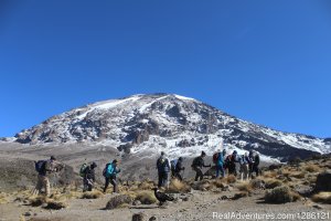
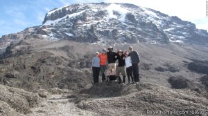
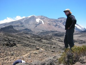
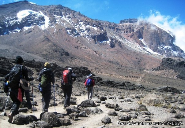
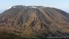
From the Shira Plateau, we continue to the east up a ridge, passing the junction towards the peak of Kibo. As we continue, our direction changes to the South East towards the Lava Tower, called the "Shark's Tooth." Shortly after the tower, we come to the second junction which brings us up to the Arrow Glacier at an altitude of 16,000ft. We now continue down to the Barranco Hut at an altitude of 13,000ft. Here we rest, enjoy dinner, and overnight. Although you end the day at the same elevation as when you started, this day is very important for acclimatization and will help your body prepare for summit day.
Day 4: Machame Hiking Route Mount Kilimanjaro Trail
Barranco Camp to Karanga Camp
Elevation (ft): 13,000ft to 13,100ft
Distance: 5 km
Hiking Time: 4-5 hours
Habitat: Alpine Desert
After breakfast, we leave Barranco and continue on a steep ridge passing the Barranco Wall, to the Karanga Valley campsite. This is a short day meant for acclimatization.
Day 5: Machame Ascent Route Mount Kilimanjaro Course
Karanga Camp to Barafu Camp
Elevation (ft): 13,100ft to 15,300ft
Distance: 4 km
Hiking Time: 4-5 hours
Habitat: Alpine Desert
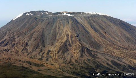
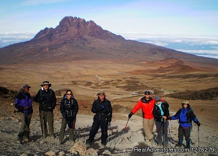
After breakfast, we leave Karanga and hit the junction which connects with the Mweka Trail. We continue up to the Barafu Hut. At this point, you have completed the South Circuit, which offers views of the summit from many different angles. Here we make camp, rest, enjoy dinner, and prepare for the summit day. The two peaks of Mawenzi and Kibo are to be seen from this position.
Day 6: Machame Trekking Route Mount Kilimanjaro Passage/Trek
Barafu Camp to Summit to Mweka Hut
Elevation (ft): 15,300ft to 19,345ft (and down to 10,000ft)
Distance: 5 km ascent / 12 km descent
Hiking Time: 7-8 hours ascent / 4-6 hours descent
Habitat: Arctic
Very early in the morning (midnight to 2am), we continue our way to the summit between the Rebmann and Ratzel glaciers. You head in a northwesterly direction and ascend through heavy scree towards Stella Point on the crater rim. This is the most mentally and physically challenging portion of the trek.
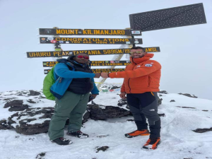
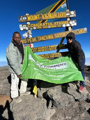
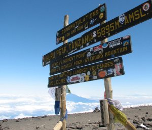
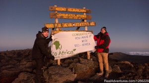
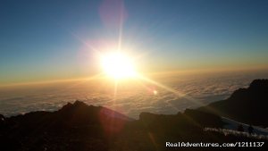
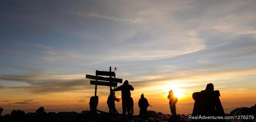
At Stella Point (18,600 ft), you will stop for a short rest and will be rewarded with the most magnificent sunrise you are ever likely to see (weather permitting). From Stella Point, you may encounter snow all they way on your 1-hour ascent to the summit. At Uhuru Peak, you have reached the highest point on Mount Kilimanjaro and the continent of Africa. Faster hikers will see the sunrise from the summit.
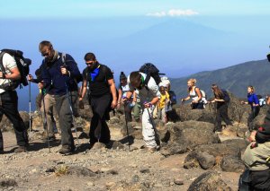
From the summit, we now make our descent continuing straight down to the Mweka Hut camp site, stopping at Barafu for lunch. You will want gaiters and trekking poles for the loose gravel going down. Mweka Camp is situated in the upper forest and mist or rain can be expected in the late afternoon. Later in the evening, we enjoy our last dinner on the mountain and a well-earned sleep.
Day 7: Machame Climb Route Mount Kilimanjaro Direction/Way
Mweka Camp to Moshi
Elevation (ft): 10,000ft to 5,400ft
Distance: 10 km
Hiking Time: 3-4 hours
Habitat: Rain Forest
After breakfast, we continue the descent down to the Mweka Park Gate to receive your summit certificates. At lower elevations, it can be wet and muddy. Gaiters and trekking poles will help. Shorts and t-shirts will probably be plenty to wear (keep rain gear and warmer clothing handy). From the gate, you continue another hour to Mweka Village. A vehicle will meet you at Mweka village to drive you back to hotel in Moshi.